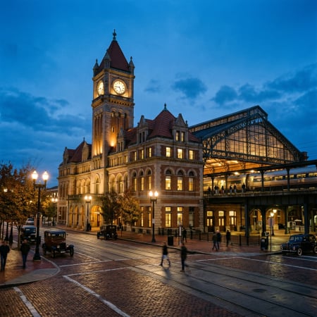
Richmond has approved a $50 million-plus redesign of the streets between Shockoe Bottom and Church Hill. The harder question is what the valley becomes around them.On August 4, Richmond's Planning Commission approved the Shockoe Valley Streets Improvement Project, a redesign that converts North 18th Street and Oliver Hill Way to two-way traffic and adds four roundabouts. Construction isn't expected to start until spring 2029. Land acquisition and utility work come first.

The short merge from northbound I-95 onto Oliver Hill Way. Much of the new design starts here.
If you've taken the Broad Street exit off northbound I-95, you know the drill. A quick merge onto Oliver Hill Way, a fast decision, and you're either headed for Broad Street or climbing toward the Leigh Street Viaduct. A good share of this plan is built to make that move smoother and slower.
Behind the engineering sits a bigger question. How much of the valley should be shaped around cars passing through, and how much around the people who live, walk, bike, and invest there?
Church Hill is one of the neighborhoods I work in most, and after more than 25 years in Richmond real estate I've learned that road projects shape a neighborhood long after the ribbon is cut. So I read the meeting coverage, the city's project pages, and the funding records. Here's what owners and buyers in Union Hill, Church Hill, and Shockoe Bottom should know.
What the Plan Actually Does
The four roundabouts would sit at Oliver Hill Way and Venable Street, North 18th and Venable, Mosby and Venable, and Leigh and Mosby. According to The Richmonder's coverage of the vote, two of them are there mainly to handle traffic coming off I-95.
Under the new layout, drivers leaving the interstate could stay on Oliver Hill Way or swing through a roundabout onto Venable Street toward Union Hill and Church Hill. The plan also adds new sidewalks, bike lanes (including two-way cycle tracks on some corridors), street trees, lighting, signage, public art, and a new traffic signal on Broad Street.

Mosby and Venable is slated for one of the four new roundabouts.
Those changes answer real problems. North 18th and Oliver Hill Way are long, straight, one-way runs that invite speeding. At the Planning Commission meeting, Jewel Trent, a young member of Just C, which runs a community center near Mosby and Venable, described what crossing there is like today.
"Me and my peers are forced to dodge cars at times because of the current traffic situation."
Hard to argue with that. The open question is whether this particular design makes the best use of the land while fixing it.
The Land Left Over
The sticking point is the roundabout at Oliver Hill Way and Venable Street. It would take up roughly a city block of former industrial land that the city plans to acquire through eminent domain, with a second roundabout right next to it at North 18th and Venable.

Leftover industrial land like this is at the heart of the roundabout debate.
Planning staff said the layout would leave too much "residual" land that the public couldn't easily use. At the July 16 Urban Design Committee meeting, member Eva Clarke pointed out that this circle would be the first thing drivers see when they come off the interstate into Richmond. It could be beautiful, she said, or it could end up as weed lots, according to The Richmonder's account of that meeting.
The city's consultants, RK&K and VHB, pushed back. RK&K said it had looked at roughly 18 other configurations, and that the steep grades and an effort to take as few private parcels as possible boxed them in. Moving the circle, the city argued, would weaken its main job of slowing cars off I-95. Public Works Deputy Director M.S. Khara put it plainly.
"Let's not have green space drive this rather than the roundabout drive the green space."
That one line sums up the whole disagreement. The city is putting traffic control first. Critics want usable public space and future buildings to carry more weight.
A second fight centers on Leigh and Mosby, near MLK Middle School, where a dedicated bypass lane would carry right turns off the Leigh Street Viaduct onto Mosby. Committee members worried it would let cars move too fast past people on foot, and member Timothy Hamnett called the bike and pedestrian routing there "really disjointed." The engineers' answer: without the bypass, traffic modeling shows cars stacking up several blocks along Mosby, which creates its own safety problems.
Worth keeping in perspective. Almost everyone in those meetings wanted the valley fixed. Ray Roakes, a city planner who serves as the committee's secretary, called about 99% of the project a vast improvement. Where people split was on the last 1%, and the land it would use up.
Moving Cars, or Building a Neighborhood?
Historic Richmond, the Shockoe Partnership, the Church Hill Association, and the Partnership for Smarter Growth all backed the two-way conversions and the bike and pedestrian upgrades. They also asked why a valley already hemmed in by the floodplain, and just starting to draw new housing, should give so much ground to roadway. Some wanted the design to do more to bring back the historic street grid, which the city itself lists as a goal.
Spencer Grice, who heads the Shockoe Partnership, didn't mince words in his letter to the commission.
"The primary motivation for this plan is to move cars expeditiously off 95N and up to the Leigh Street Viaduct."
Public Works Director Bobby Vincent, defending the plan, called the area as it stands today "a concrete wasteland." Both men are describing the same place. It needs a better street network, and the shape of that network will decide how much land is left for homes, shops, and public space.
That matters more here than almost anywhere in the city. Shockoe Valley carries deep history, a growing number of residents, and plans for a major heritage campus. And once curbs are poured and roundabouts are built, they tend to stay put for a very long time.
Why Funding Pressure Shaped the Vote
Both Planning staff and the Urban Design Committee recommended denial. The commission approved it anyway, with only Chair Rodney Poole voting no. Money had a lot to do with that.
Two hours before the meeting, Larry Hagin, a director in VDOT's Richmond District, emailed the city. Depending on what the Planning Commission or City Council decided, he wrote, VDOT was prepared to make a recommendation to the Commonwealth Transportation Board that could include pulling the project's funding and seeking repayment of money already spent. In fairness, a city spokesperson had told The Richmonder weeks earlier that the state confirmed there's no specific Smart Scale deadline requiring construction to start by a certain date. Still, the message was clear enough.
The project began a decade ago. When the concept came before the city in 2019, it was estimated at about $28 million. Federally required archaeological and cultural reviews, needed because of the area's history, have stretched the timeline, and the cost has climbed with it. Even the city's own documents don't agree on the current number.
Published estimate | Source |
|---|---|
$49.6 million | February 2026 steering committee update (November 2025 pricing) |
$51.743 million | Project funding page |
$54 million | City quarterly capital report through June 30, 2026 |
That June report showed $38.287 million appropriated, $15.713 million still needed, and design about 70% complete. The bulk of the funding is lined up: roughly $33 million through the state's Smart Scale program plus a $14 million commitment from the Central Virginia Transportation Authority.
Several commissioners said out loud what that pressure felt like. Commissioner Burt Pinnock noted it seemed "kind of challenging to pull it back." Commissioner Rebecca Rowe went further.
"I will support this project, but I feel held hostage in a lot of ways, and I resent that."
That's the other side of the debate. Rethinking a design can be worth it, but doing so after ten years and tens of millions in committed money carries real risk too. The vote moved the project forward. It didn't settle whether this is the best long-term use of the valley's land.
When You'll Actually See Changes 🚧
Not this winter. Per the city's capital project page and published schedule, here's the rough order of things:
- Fall 2026 through 2027: right-of-way acquisition
- By summer 2028: utility relocation
- Fall 2028 to early 2029: construction bids advertised and contract awarded
- Spring 2029: construction expected to start
- Spring 2031: expected completion
The city is clear that the construction dates depend on the project being fully funded.
A VDOT environmental document dated September 2, 2026, identifies 3.44 acres for outright purchase, 0.34 acres of permanent easements, and 2.04 acres of temporary easements, along with one commercial relocation on Venable Street. So the first signs of progress will be appraisals, offers, and utility crews, well before any bulldozers.
Development Is Moving Faster Than the Roadwork
While the streets work through the process, the valley around them keeps changing.

Main Street Station, home to the Shockoe Institute's first exhibit.
The Shockoe Institute opened its interpretive center inside Main Street Station in April 2026, with an inaugural exhibit called "Expanding Freedom." According to Axios Richmond, it's the first major piece of the city's $265 million Shockoe Project, which will also include a memorial at the African Burial Ground and new public space tied to the Lumpkin's Jail site.
Housing is moving too. 🏗️ On October 1, Richmond BizSense reported that the city picked Historic Housing's Seabrook proposal for the one-acre city-owned parking lot at 212 North 18th Street. The plan calls for an eight-story, 190-unit mixed-income building, with at least 57 apartments set aside for households earning up to 80% of area median income. It sits across from The Bakery, the 12-story, 211-unit building Historic Housing opened in 2025.

Surface parking beside new towers. Seabrook would fill a lot like this one.
Seabrook still needs a development agreement and City Council approval, but construction could begin as early as August 2027. If that holds, it'll be going up well before the first roundabout. The site's zoning is also part of the city's Code Refresh zoning rewrite, which would allow considerably taller buildings there.
New apartments, a heritage campus, better sidewalks, and new public space could all change how the valley feels day to day. The street design will decide how well those pieces connect.
What This Means If You Own Nearby

Union Hill, a few blocks uphill from the project area. Distance from the work zone will matter block by block.
New infrastructure doesn't automatically raise values. Construction brings two years or more of noise and detours, and the payoff depends on what the finished streets feel like and what gets built beside them.
If you own near Venable, Mosby, or North 18th, it's worth knowing exactly where your property sits relative to the planned roundabouts and easements. If the city's appraisers contact you, talk with your own attorney and appraiser before you respond.
If you're buying, think about your timeline. A purchase today with a five-year hold lands right in the 2029 to 2031 construction window. That doesn't rule anything out, but it does mean picking the block carefully and pricing it right.
And if you're thinking about selling in the next few years, timing matters. Listing before crews arrive, or after the new streets open, may play very differently than listing in the middle of it.


Common Questions About the Shockoe Valley Street Plan
When will construction start on the Shockoe Valley streets project?
The city expects construction to begin in spring 2029 and wrap up in spring 2031, as long as the project is fully funded. Right-of-way acquisition and utility relocation come first, running through 2028.
Will the city take private property for the roundabouts?
Yes, in some places. The city plans to acquire a former industrial block at Oliver Hill Way and Venable Street, and a September 2026 VDOT document identifies about 3.44 acres to purchase plus permanent and temporary easements, including one commercial relocation on Venable.
How will the plan change the I-95 exit at Broad Street?
Drivers coming off northbound I-95 will be able to stay on a two-way Oliver Hill Way or use a new roundabout to reach Venable Street toward Union Hill and Church Hill. Two of the four roundabouts are designed mainly to slow and sort that exit traffic.
Will the project raise home values in Church Hill and Union Hill?
Nobody can promise that. Safer streets and new development can help, but construction disruption and the quality of the finished design will matter, and the effect will vary a lot from one block to the next.
Sources: The Richmonder, coverage of the July 16, 2026 Urban Design Committee meeting and the August 4, 2026 Planning Commission vote. City of Richmond Department of Public Works, Shockoe Valley Streets Improvement Project capital project page and quarterly capital report (through June 30, 2026). VDOT environmental document dated September 2, 2026. Richmond BizSense, October 1, 2026. Axios Richmond, April 9, 2026. Schedules and cost estimates are as published by the city and may change. This post is for general information and isn't legal advice.