Richmond starts resurfacing the Mayo Bridge on Tuesday, October 13. When crews wrap up around October 23, the bridge reopens with one travel lane in each direction instead of two, the same lane count VDOT shows for the $190 million bridge that will eventually replace it. Written comments on that replacement are due November 1.

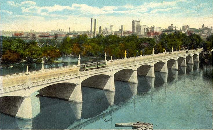
The 14th Street Bridge, as it was known then, on a postcard from around 1917. Same bridge you drive today, give or take a century of patches.
The city grades its streets on a Pavement Condition Index that runs from 0 to 100. The Mayo Bridge currently scores a zero, which the city says means the surface has reached the end of its useful life. I've had lowball offers come in higher than that. 😅 So the repaving isn't optional. What's interesting is what the city does with the fresh asphalt.
I've sold homes on both sides of this river for more than 25 years, and the Mayo Bridge comes up in nearly every Southside conversation I have. For buyers in Manchester, Woodland Heights, Forest Hill and Westover Hills, it's the quick hop to Shockoe Bottom, the Canal Walk and downtown. When that crossing changes, daily routines change with it. So I read the fine print on this one, and here's what I found.
Eleven Days of One Lane Each Way
The city expects to resurface the bridge October 13 through 23, weather permitting. Lane closures run from 9 a.m. to 6 p.m. daily, with one lane open in each direction and detour routes posted. The work covers the full stretch from the north floodwall to the south floodwall, approaches included.

The floodwall path on the Manchester side. People on foot are a big part of the case for wider shoulders.
If you cross before 9 a.m. or after 6 p.m., you probably won't notice much. Midday is a different story. If you've got a lunch in Manchester or a showing on the other side of the river, give yourself a few extra minutes, or plan on the Manchester Bridge or the Lee Bridge instead.
For a week and a half, the work zone and the finished layout carry the same number of cars. The only real difference is cones.
What the Stripes Look Like After October 23

Today the outer lane runs right along the bridge sidewalk. The pilot swaps it for a full-width shoulder.
Once repaving is done, the bridge moves from four lanes to what the city calls a two-lane pilot road diet: one travel lane each way, plus full-width shoulders. The city says the setup is meant to show how the corridor works with fewer lanes, handle traffic during upcoming construction, and put more space between moving cars and the bridge sidewalks.
Andy Boenau, the city's Director of Transportation, put it this way in the announcement: "Resurfacing the Mayo Bridge provides a smoother, safer ride today while allowing us to test operational changes that will help manage traffic for upcoming construction projects." The Richmonder reported that the city plans to collect data from the pilot to inform decisions about the rebuild. That's the part I'd pay attention to. This is paint on old concrete, but it's also a field test.
Here's how the three versions of the bridge compare.
Today | Pilot, after Oct. 23 | VDOT replacement | |
|---|---|---|---|
Vehicle lanes | Four | Two, one each way | Two, one each way |
Beyond the travel lanes | Bridge sidewalks | Full-width shoulders, then sidewalks | Bike lanes and a separated pedestrian walkway |
Speed limit | 35 mph | No change announced | 25 mph |
Status | Pavement score of 0 | Temporary pilot | In design, about $190 million |
The Replacement Plans Already Assume Two Lanes

A cross section of the finished bridge as currently designed. Two lanes for cars, and a lot more room for everyone else.
The current bridge dates to 1913. VDOT lists the replacement as in design, with an estimated cost of $190 million and start and finish dates still to be determined. The latest typical section shows two vehicle lanes, dedicated bike lanes, a separated pedestrian walkway, a speed limit dropping from 35 to 25 mph, and traffic calming on Mayo Island.
In January, the city's Urban Design Committee approved a preliminary design with conditions, according to Richmond BizSense. That version bends at Mayo Island instead of running straight across, which would let the old bridge stay open longer while the new one goes up. Committee members pushed for protected bike lanes and safer crossings at the island, where a future park could put hundreds of people on both sides of the road.
Not everyone sees two lanes as a pure win. At that same meeting, Anthony Jones, an engineer with the Richmond Fire Department, told the committee his department runs around 5,000 emergency calls across the bridge each year, more than 13 a day on average. With one lane each way, drivers need somewhere to pull over so fire trucks can get through. It's a fair point, and the pilot's full-width shoulders give the city a live test of exactly that question.
My read: the lane count is settled. What's still open is how to split the rest of the width, and that's where a few weeks of real driving makes your comment worth more.
How to Weigh In Before November 1
VDOT's citizen information meeting falls in the middle of the repaving, so by then you'll have about a week of one lane each way behind you. Here are the dates in order. 📅
October 13 to 23. Resurfacing, with daytime lane closures and one lane open each way.
Wednesday, October 21, 5 to 7 p.m. Drop-in open house at the PlanRVA office, 424 Hull Street, Suite 300. VDOT and project staff will be there to walk through the concepts. Otto is on the ground floor of the same building, so you can grab a döner bowl on your way up.
After October 23. The two-lane pilot begins once resurfacing wraps up.
November 1. Deadline for written comments. You can turn them in at the meeting, online, by mail to William Wheeler, P.E., VDOT's project manager, at 2430 Pine Forest Drive, South Chesterfield, VA 23834, or by email to [email protected] with "Mayo Bridge Replacement Project" in the subject line.
November 4. Weather backup date for the open house, same time and place. VDOT's notice doesn't say whether the comment deadline moves if the meeting does, so I'd send yours online or by email to be safe.
If the new striping goes down right after October 23, you get roughly a week of driving the future layout before comments close. Rain could shorten that, so don't wait for the last day.
The South End Gets the Next Round of Work
The city says outright that the pilot is tied to construction coming to Manchester's side of the river. Two projects matter most.
Hull Street Streetscape. This one runs from the Mayo Bridge to 9th Street. The scope covers new and repaired sidewalks, curb ramps, signal and streetlight upgrades, street trees, street furniture and new crosswalks. Dedicated bike lanes aren't part of it. The city put the job out for bids in June, with bids due July 29 and a contract period of 540 days. I haven't seen a contract award or start date announced yet, so any older timeline you've read for this corridor is out of date.

Mayo Island from above, with today's bridge and the planned new path. The bend at the island lets the old bridge stay open longer during construction.
Manchester Canal Bridge. This is the short Hull Street span over the canal, only about 41 feet long. The Richmonder reported that it has to be replaced before Mayo Bridge construction can start. The plan is to build it with room for four lanes and then restripe it to two once the new Mayo Bridge is finished, so it matches both versions of the corridor.
Then there's Mayo Island itself. Demolition site prep began July 6, and the city expects demolition, cleanup and stabilization to continue through October. The island stays closed while that happens. The finished park calls for walking trails, open green space and restored native plantings. City leaders had pointed to an October 2026 opening last year, but the city's July update didn't give an opening date, and I haven't seen a new one since. The city's case for wider shoulders on the bridge leans partly on that park, which is why getting people safely onto the island comes up in both the pilot and the permanent design.

Otto on Hull Street, a short walk from the south end of the bridge.
Meanwhile, the blocks near the bridge keep getting better to walk. Otto, a Turkish and Mediterranean fast-casual spot out of Charlottesville, opened this summer in part of the old food hall space at The Current on Hull Street. The Sassy Biscuit Co. also debuted in Manchester this summer, serving breakfast, lunch and brunch built around owner Jilan Hall's drop biscuits. Upriver at the Manchester Climbing Wall, below the T. Potterfield Bridge, Friends of James River Park has been clearing invasives off the hillside, planting a cover crop and following it with a native wildflower and grass mix.
What I'm Telling Clients
Nobody has reported yet on how the road diet actually works day to day, because it hasn't started. The first real reviews will come from the people driving, walking and biking across it this fall. That's an opportunity if you're making a decision on this side of the river.
If you're buying in Manchester or the Southside neighborhoods that lean on this crossing, drive it at the hours you'd actually commute once the pilot is in. It's the closest thing to a preview of the next 50 years you'll get. If you're selling near Hull Street, think about timing. Streetscape work is messy while it's happening and a real asset once the trees and lighting are in. Knowing roughly when crews show up helps us decide when to list and how to talk about it with buyers.
Construction is temporary. A better walk to the river is not. The trick is pricing for the first while selling the second.


Common Questions About the Mayo Bridge Changes
When is the Mayo Bridge being repaved?
The city plans to resurface it October 13 through 23, 2026, weather permitting. Lane closures run 9 a.m. to 6 p.m. daily, with one lane open in each direction.
Is the Mayo Bridge going down to two lanes permanently?
The striping after October 23 is a pilot. The permanent replacement VDOT is designing also shows two vehicle lanes, but that bridge has no construction start date yet.
How do I comment on the Mayo Bridge replacement?
Attend the October 21 open house at 424 Hull Street, or send written comments online, by mail or by email to VDOT project manager William Wheeler by November 1.
When will Mayo Island Park open?
The city hasn't confirmed an opening date. Demolition and site work are expected to continue through October 2026, and the island stays closed until that work is done.
Will construction affect homes near Hull Street in Manchester?
The Hull Street Streetscape and Manchester Canal Bridge projects will bring work zones to the blocks between the bridge and 9th Street. Start dates haven't been announced, so it's worth checking the latest before you list or buy.
Sources: City of Richmond resurfacing announcement (Oct. 6, 2026) as reported by WTVR, WRIC and The Richmonder; VDOT Mayo Bridge Replacement project page and events calendar; Richmond BizSense on the Urban Design Committee review (Jan. 16, 2026) and Otto (Aug. 4, 2026); The Richmonder on the Manchester Canal Bridge; City of Richmond Hull Street Streetscape invitation for bids (June 11, 2026); City of Richmond Parks update on Mayo Island (July 14, 2026); Richmond Magazine Food News (Aug. 2026); Friends of James River Park. Project dates, costs and comment details are subject to change. Confirm with VDOT and the City of Richmond before relying on them.